Lengauer Besinnungsweg

Hiking

favorite_borderfavorite
play_arrowpause
  • EasyLevel
  • access_time1:39 hDuration
  • arrow_right_alt5,3 kmDistance
  • terrain911 mHighest point
  • trending_up267 mUphill
  • trending_down273 mDownhill
  • Show map
Lengauer Besinnungsweg.jpg

Tour information

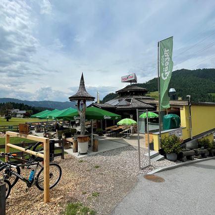
The starting point of this hike is the car park at the Salvista Gondelbahn in Itter.  From there, follow the signs for path no. 7 through the underpass towards Lengauerkapelle. On the forest path, follow path no. 1 towards Lengauerkapelle.  At the Badhaus, follow the road towards the district of Ried, where you turn left. You return to the starting point via path no. 1 in the direction of Itter.
 

Read more

Info

Lengauer Besinnungsweg

Features

  • check easy
  • check
  • check
  • Asphalt, walking path, forest path, gravel road
  • outdoor clothing sturdy footwear sufficient food and drinks first aid kit mobile phone with a full battery & charger hiking map & guidebooks possibly a GPS device or download the GPS data onto your phone sun protection (sunglasses, sunscreen & cap) rain protection cash
  • From Innsbruck/Munich: A12 exit Wörgl Ost - feeder road B178 towards St. Johann i.T. & Kitzbühel - after passing through the tunnel, continue straight ahead for approx. 3 km - destination is on the right-hand side.
    From Kitzbühel: From the B161 feeder road take the B178 towards Oberndorf i.T. - stay on the B178 for approx. 4km towards Going am Wilden Kaiser/Stanglwirt - at the crossroads opposite the Stanglwirt turn right onto Loferer Straße - continue on the B178 towards Ellmau/Scheffau/Söll/Itter - destination is after approx. 16km on the left hand side
  • Bus: Dorfplatz Itter

    Regional Guest Card = Train ticket from Kirchbichl to Hochfilzen + Bus ticket from Mariastein to Kitzbühel included! 

    Valid on ÖBB local trains (S, REX) and InterRegio trains (IR) between Kirchbichl - Wörgl and Hochfilzen
    Not valid on RJ, RJX, EC, IC, ICE, D and NJ/EN trains

    More detailed information at: www.hohe-salve.com/mobilität
  • Parking facilities directly at the valley station

Restaurants & infrastructure

Similar

Embachrunde

EmbachrundeEasy
Embachrundeaccess_time1:41 harrow_right_alt5,2 kmfavorite_borderfavorite

Lindweg

LindwegEasy
Lindwegaccess_time1:45 harrow_right_alt5,1 kmfavorite_borderfavorite

Obwiesen

ObwiesenEasy
Obwiesenaccess_time1:30 harrow_right_alt5,7 kmfavorite_borderfavorite