Hundalm ice and stalactite cave past the Buchacker Alm

Hiking

favorite_borderfavorite
play_arrowpause
  • Open
  • MediumLevel
  • access_time5:30 hDuration
  • arrow_right_alt13,7 kmDistance
  • terrain1495 mHighest point
  • trending_up890 mUphill
  • trending_down890 mDownhill
  • Show map
Wandern Herbst Buchacker Höhenstein 2022@Region Hohe Salve - Mathäus Gartner (8).jpg

Tour information

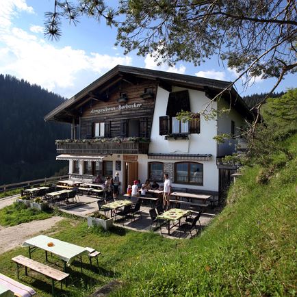
The starting point of this hike is the Lettenbichl car park in the Embach district of Angerberg. From there you walk upwards in serpentines along a well-built and secured forest path. After about 2.5 hours you reach the first waypoint: the cosy Buchacker Alm.
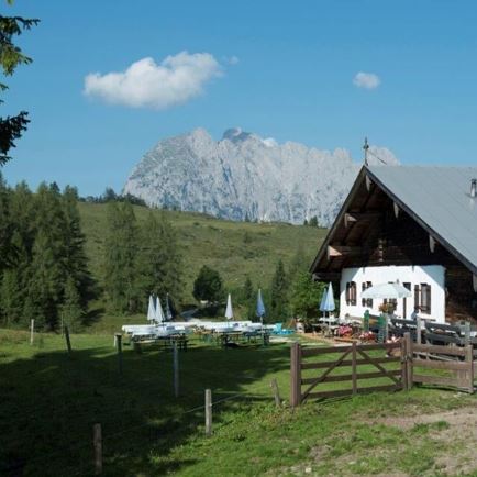
Then continue on the trail of the Tiroler Adlerweg to the Adlerhorst viewing platform. 
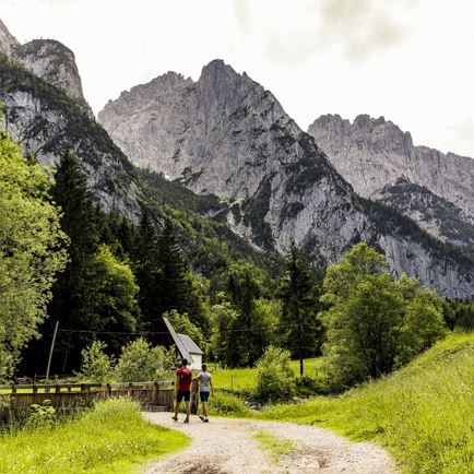
Here you hike along a forest and meadow path to the entrance of the ice and stalactite cave. The cave at Hundalmjoch is the only show cave in the North Tyrolean Alps where you can see ice and stalactite formations.
You then return to the starting point via the ascent path.

Tip: A detour to the Buchacker summit cross should definitely be planned.

Read more

Info

Hundalm ice and stalactite cave past the Buchacker Alm

Features

  • check medium difficulty / red mountain path
  • Forest path, wood trail
  • outdoor clothing Sturdy shoes sufficient food and drinks First aid kit Mobile phone with full battery & charger Hiking map & guide literature Possibly a GPS device or download the GPS data to your mobile phone Sun protection (sunglasses, sunscreen & cap) rainwear, cash
  • Coming from Innsbruck/Munich: A12 exit Kirchbichl - at the crossroads turn left onto Kirchbichler Straße - at the roundabout take the 3rd exit towards Mariastein - follow the road for approx. 6km - 50m after Hotel Kraftquelle Schlossblick turn right - follow the signs to your destination.

    Coming from Kitzbühel: Take the B170 Brixentalstraße in the direction of Wörgl - after Hopfgarten, take the 2nd exit at the roundabout onto the B178 in the direction of Bruckhäusl - follow Loferer Straße until the B171 forks to the right - after 30 m, turn left onto Europastraße in the direction of Angerberg - follow Angerberger Landstraße for approx. 7 km - after passing through the village, turn right onto Unterinntaler Landstraße in the direction of Mariastein - 50m after Hotel Kraftquelle Schlossblick, turn right - follow the signs to the destination.
  • bus: Angerberg Franzlerbrücke 


    Guest card = travel ticket - bus & train included! 

    Online timetables:


    www.vvt.at

    www.oebb.at
  • Hikers' car park to the left of Hotel Kraftquelle Schlossblick, Embach 1, 6320 Angerberg

Restaurants & infrastructure

Similar

Hornweg

HornwegMedium
Hornwegaccess_time5:30 harrow_right_alt13,6 kmfavorite_borderfavorite

Kröndlhorn

KröndlhornMedium
Kröndlhornaccess_time7:00 harrow_right_alt13,5 kmfavorite_borderfavorite